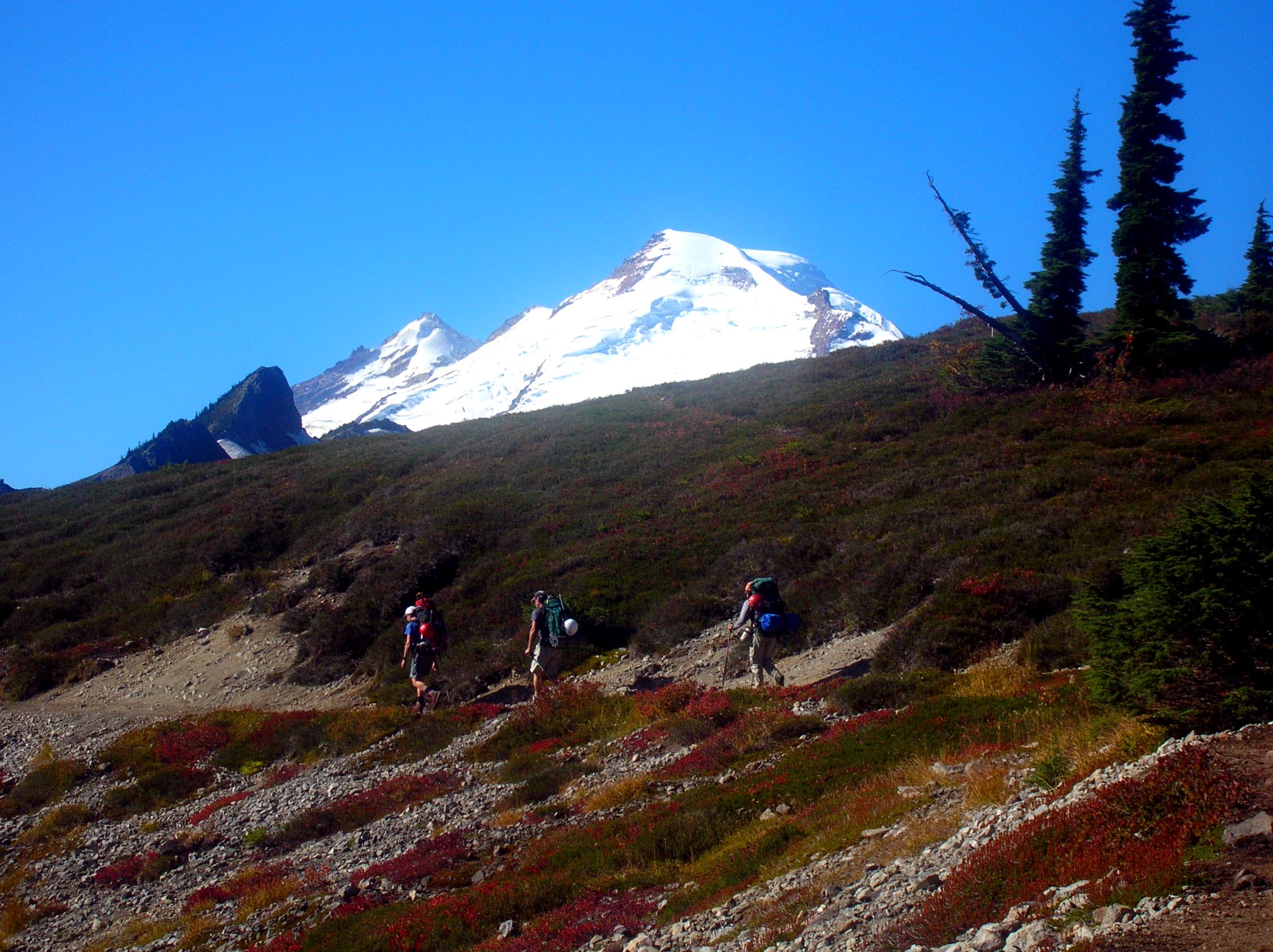
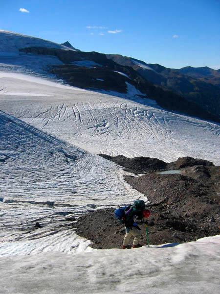
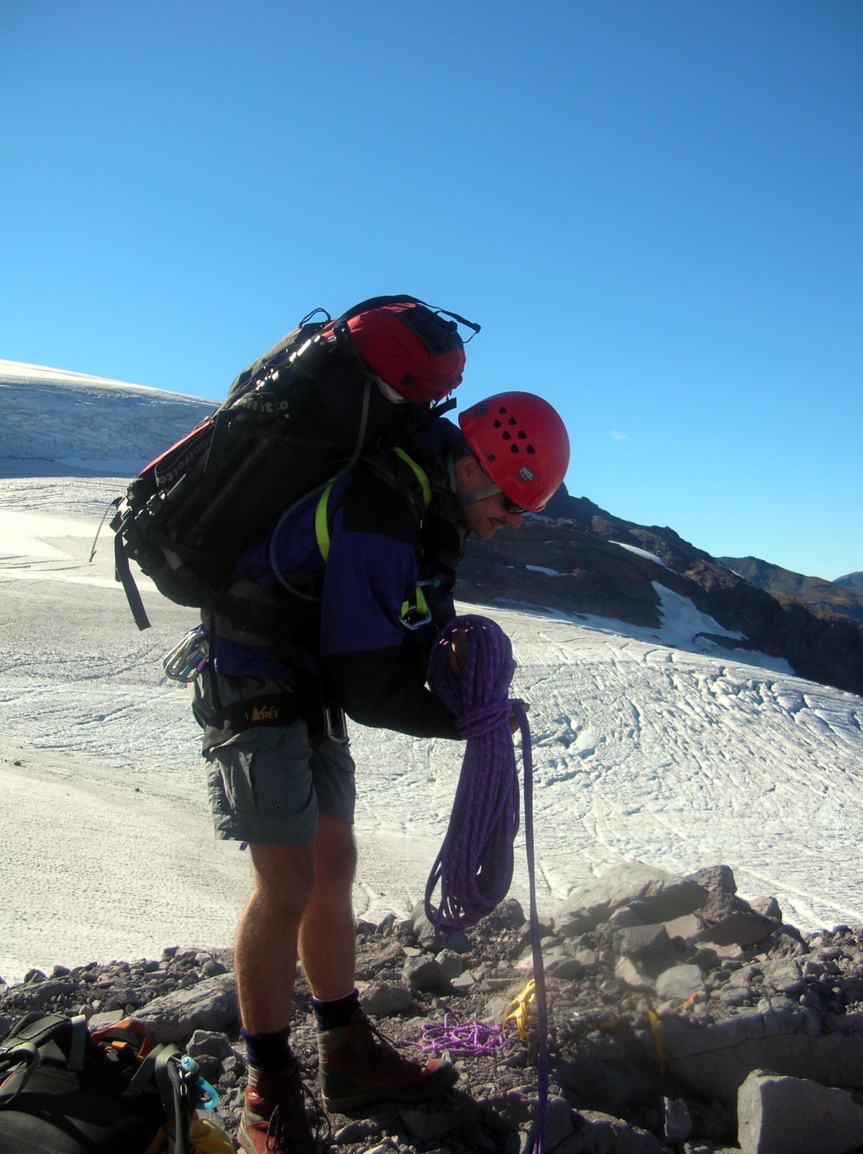
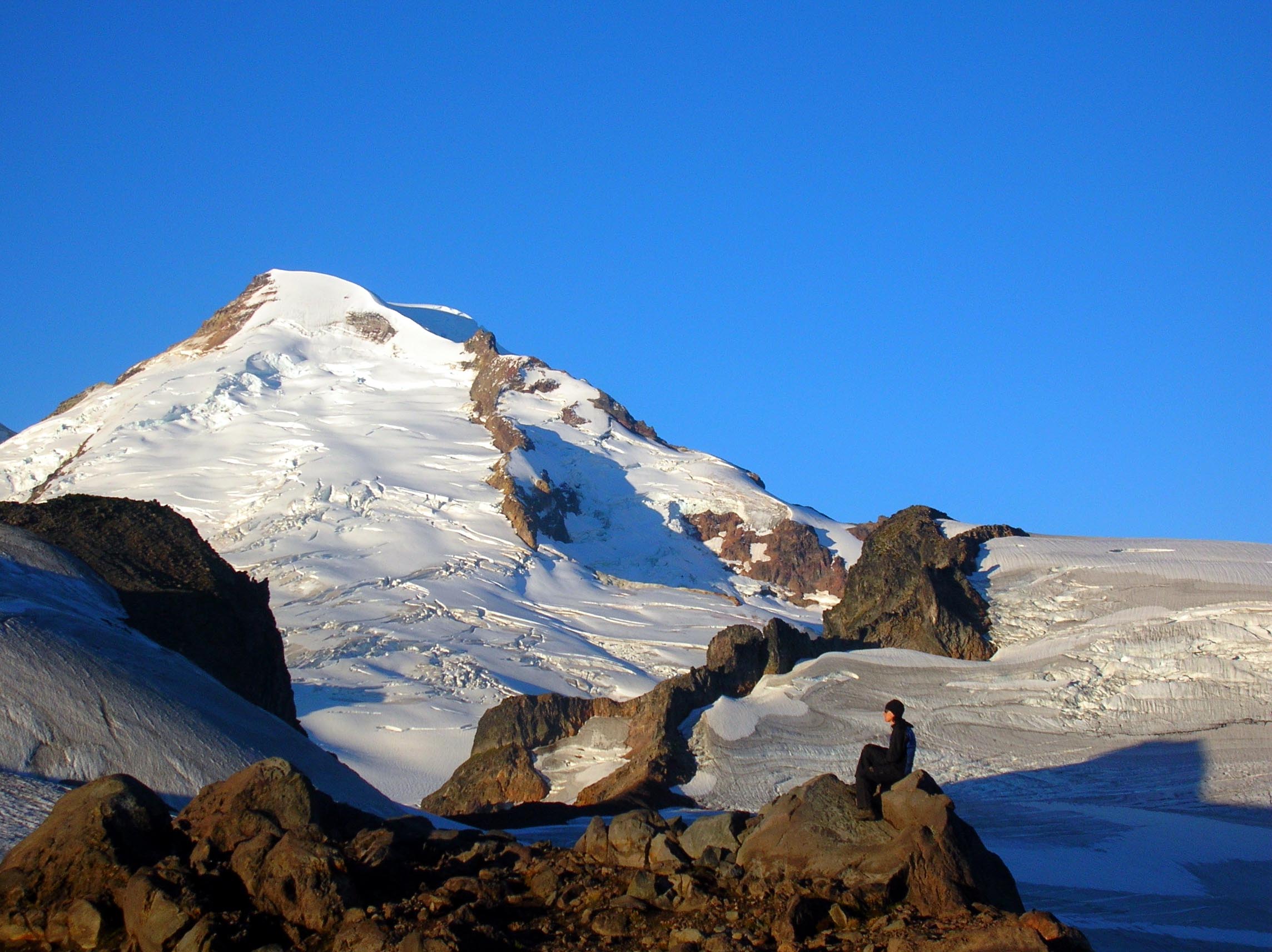
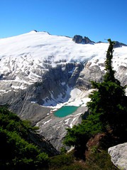
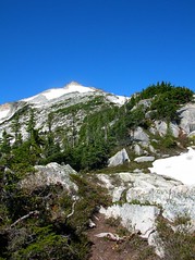
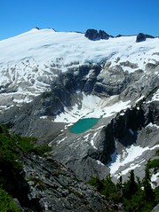
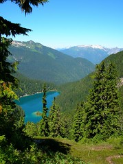
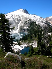
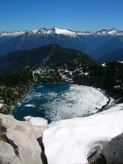
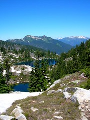
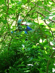
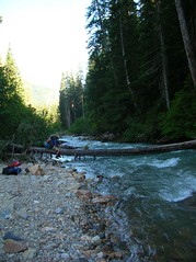
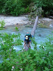
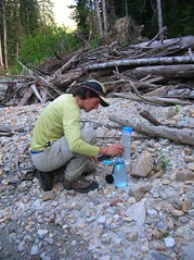
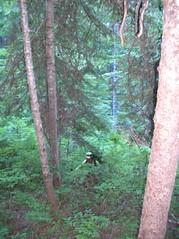
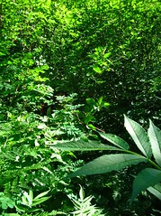
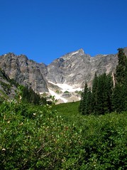
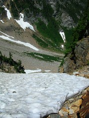
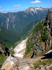
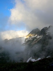
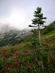
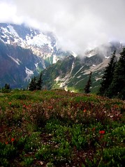
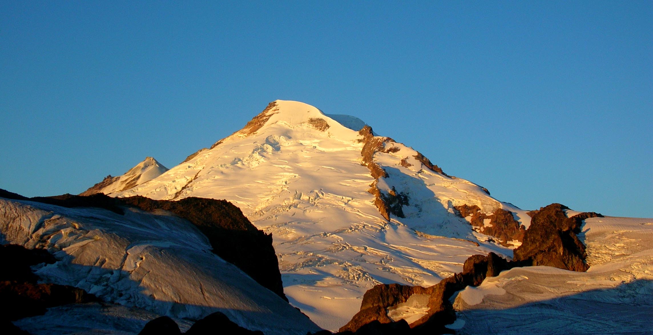
Stay tuned for more reports ands pics...

1. West McMillan Spire
2. Baker traverse to Hadley Failed attempt.

3. Snowking attempt.

4. Luna Attempt.


West McMillan Spire

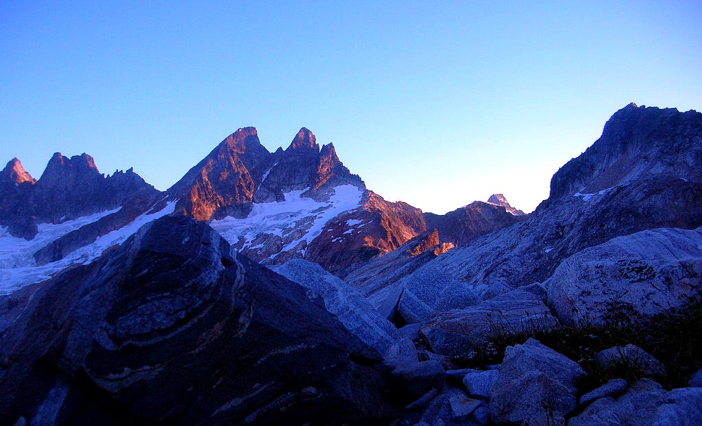
It is hard to describe terror basin and the climb up West McMillan spire in word and pics but I will try.

Dicey,  Josh's (my son)Truck Tigger, and I arrived at the Goodell creek TH Friday morning. Truck tigger didn't want to stay in the truck so he came to climb with us.
The TH is at 600' and is a climbers path that runs up the river valley for about 4 miles. The path is brushy but still easy to follow.  Around 4 miles give or take the path takes a turn at a camp with a fire ring. At 1600' or so The path turns right and goes strait up a ridge.  When I say strait up I mean it...it kicked my butt.  It gains 3500' in 1-1.5 miles.  Many areas the vegetation and trees are your friend.

At around 5000 ' the views start to appear.  the path starts to mellow a bit and drops down to a stream crossing(now water).  at 5200'  you come to a second stream with very little water. climb up the stream bed of large boulders for 100 feet and find the caire. this is where the traverse begins.  The traverse runs though meadows, slab and rock with incredible views to the south and west.

Dicey arrived at the 6200' foot saddle before me and was waiting for me when I arrived.  The plan was to descend  down from the saddle into the basin for camp.   That is not what happened. The steep slope is a mess of dirt, scree,loose and unstable rock. After Dicey tested the slope and we both looked at it, neither one of us wanted to descend it with our heavy packs.  Dicey had a great idea to look for camp up higher with views and we could descend in the AM without heavy packs. Dicey went up the ridge to look fro a camp and water. she found a great spot with views that don't stop.  Tigger liked stomping in the heather lol.

The next morning we headed down the nasty slope to the basin.  It was bad every step was loose and scary.

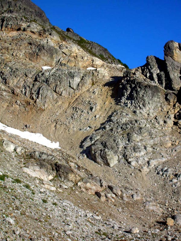
After dropping down from the saddle hug the right side near the base of the cliff and helmets are suggested. Once down off the slope we descended a snowfield to the glacier stream and followed it down to the basin where the camps are at 5800'.

There was a tent up there near a tarn. We saw a guy and he waved as we came closer.  We stopped to talk to him and Josh said he is from Ohio and just got back from living in Argentina for 7 years.  He hitched rides and took buses to get to the NCNP for this backpack. As we are talking he asked if he could catch a ride back with us to seattle.  We said ya no problem. He said he would cook us dinner after the climb so how could we pass that up?    As we climbed for the day Josh was going to move his camp up to ours.

We started up to the saddle to get a look at lake Azure. We scrambled up slab and rock to a notch at 6200' and took a break and snapped some pics of the lake. Now it was time to tackle The Spire.We descended from 6200' to 5500' when you cross an outlet from a thawed glacial lake.
The lake is very nice and so green.

From here you traverse a bit around a ridge and start to head up the terror glacier.
We scrambled up rock and slab  to reach the glacier. We stopped and put our crampons on and checked out the route.  We head up the side of terror glacier and skirted around some tiny crevasses. up to the snow finger in a gully. The snow finger was very steep around 40 degrees or so.  It was great fun.  The finger is very thin and skinny up at the top so in a few weeks or sooner it will collapse.  at the end of the finger we stashed our crampons and started the scramble up the summit ridge. The ridge is also very steep with a lot of loose rock and scree but some good rock to play on too.  At the top you run into a false summit that is really nice.  From there is a scramble along a small ridge with some exposure to the summit block 8000'.


The views well.........WOW is all i can say.

The pickets, shuksan, baker, south to glacier and all the other many peaks you can see.  Tigger insisted he have a summit pics so i took one.

We spent about an hour and headed down.  The sun was hot and there was a little concern about the snow finger collapsing under us so we got going.

The descent down the ridge was fine.  We needed to get back to our crampons so we followed the same route we took up.  Well it is not always easy to go down what you went up :rolleyes: . We tried skirting around some slab but it was too exposed. so the other option was a tunnel of mud between the snow finger and the cliff base with an overhang. Dicey went first.  She was successful till the last ten feet or so and then ran out of move.  Then she slipped and slid in the mud for about 10'+  :eek: . Just enough to get the adrenaline pumping. I followed and did the same thing. There was nothing that we could have done with the situation but slide in the mud.

We reached the crampons with mud covered butts legs and hands.  my adrenaline was pumping so good now that my knees where shaking.  I hate descending steep snow just a peeve.  Dicey started down.


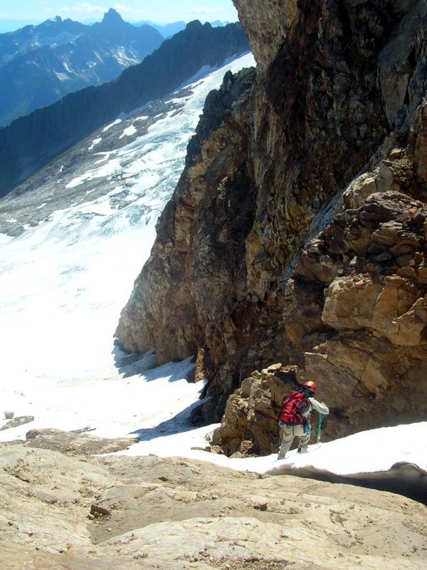
I told her  that I would find a route down the rock.  HA! not a chance got part way down a slick slab with no holds and started to slip. That was when I did a backward spider climb back up to safety as quick as I could.  OK.... WHEW....BREATH!!!! BREATH!!!!! that was all i could do to try to calm down. After the mud slide, the rock slip and the thought of having to descend that steep snow I was freaked.
I had no time to sit and ponder to calm down Dicey was halfway down the snow finger and it was my turn.  I put every bit of concentration in each step.  With the help of Dicey's steps,  some encouragement, and instruction I calmed right down and made it down safe and sound.  We removed our crampons and did a little glissade. It helped clean the mud off  :lol: .

the traverse back to the camp areas was uneventful.


Now the only obstacle was to ascend that saddle back up to camp.  Dicey went first and I waited till the danger of rock would be clear.  I have never hugged rock the way I did getting up that slope.  every step I took seemed to not want to hold at all. I was so glad when I reached the top.

When we reached our camp our new friend was waiting.  He was ready took cook us dinner after high fives were given.  He made something and I can't remember the name but it was good and filling. After some good food, conversation and a great sunset we all retired.

The next morning we got out slow. The worst part of the way back to the th was the steep section on the ridge. It pounded the heck out of me. But it was nice to have a good 4 mile cool down before the truck.

This was and will be one of my favorite climbs. Great area Great climb companion and got to meet and get to know Josh.  I am glad Tigger came along cause it was a nice reminder of what i have back at home. Plus he loves to climb :lol:   I hope that Dicey will pipe in with her experience of the climb and maybe some more pics too.

brought crampons...used them but didn't need to
ice axe...used them
helmets...used them

my altimeters said total acc elevation was 13, 300+'  I think that is gain and loss maybe.  I know my muscles are telling me it was alot!

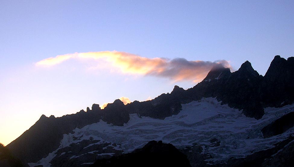
Baker traverse to Hadley peak attempt

To me this weekend was all about good people with great views!. Dicey had a great idea and a different approach to summit Hadley peak.  The plan was to traverse from Artist point to Hadley and out Chowder ridge and skyline. In early season or a better snow year this would have worked well.

Carla schauble and I met with Don Gyer and Jeff Rogers at the skyline TH. I left my truck behind and we all headed to Artist point.


Headed out to ptarmigan ridge stopped at Colman pinnacle and those three ran up to the summit while I stayed and watched the packs  :embarassedlaugh: . They ran into some goats too.  While I was waiting for them two guys in full camouflage gear with full packs (heavy ones)and a rifle walk buy. They where hunting for bear! :eek:

Just below the first Portal we roped up to start the traverse across Sholes Glacier. These two pictures of Carla and I are taken by jeff Rodgers as we are exiting the glacier.


BTW Don carried the rope up, thanks Don! We had to weigh him down with something, this guy can move.


We didn’t get too far.  After about 15 minutes on the glacier we ran into a moat with not too many options and the options we did have didn’t sound too pleasing. We all knew the conditions where not the best for what we wanted to do. I also think in the back our minds we all knew this was a long shot.  We all looked at the options and even if we did get across this moat what would we find beyond the next ridge getting onto the Mazama glacier more moats?  Time to flush the traverse, BUMMER!!!

                                          
We decided to set up camp on the ridge just below the first Portal and just enjoy the afternoon/ evening kicking back,  hanging with friends and taking in the beauty.


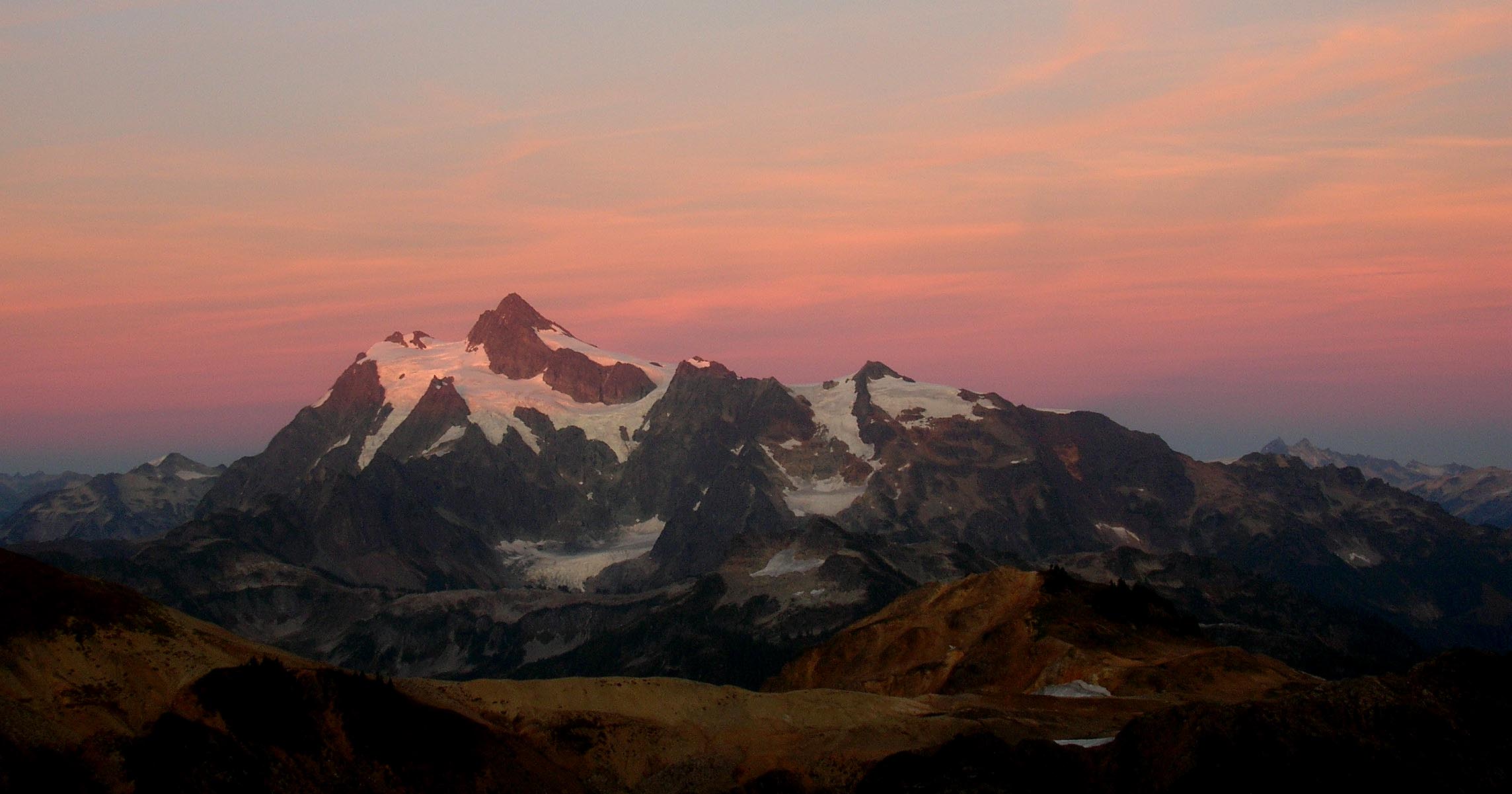
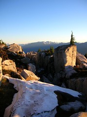
The next morning we will pack out and try for Hadley the Skyline/ Chowder ridge route.  We had a nice sunset and sunrise but my pics didn’t come out that great so hopefully someone can post some of the sunset. Dicey sitting on the rocks warming in the sun for another day of bouncing up a mountain.


After breakfast packed up where back ate the truck.

Time was not on our side today and we also had a gas issue. Don’s truck didn’t have enough gas to get back up to skyline so we had to go get gas.   We didn’t hit the trail till 12:30 . They all took off down the trail and  I stayed back. I knew I was not going to summit that day so my motivation was deflated.  I knew I could never catch them, they where gone in no time. Out of my league when it comes to speed accents.  I enjoyed hiking up and around on skyline ridge and hung out in the sun for a while. The colors are nice up there now and the views are just awesome!


Dicey, Don, and Jeff kept going with the summit in mind. They met up with me on the ridge and we all hiked out together.
They didn’t make the summit.  Please pipe in guys with your account and pics of the trip.

It was great to hang out with all of you and I always learn something new and I love that the most. Thanks for all the fun.  I still think traverse idea is a good one.  I  will go back and do that route when the time and conditions are right next year!


Being an idiot on Snowking

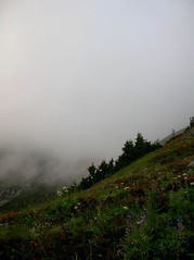
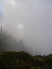
“I think we should turn around here, I am not feeling well at all” I said.

“Really it is so close?” replied Matt.

“Ok a bit further and we will see what time it is and see how we are feeling then”

We were running out of time and the sun was so intense I was feeling dizzy and nauseous. I couldn’t even walk strait and had not one once of energy left. I couldn’t get enough water. I knew I had to cool down and drink more. The sun was sucking all the water right out of me.

Thursday and Friday I hooked up to climb Snowking with a dear friend Matt. I knew it would be a good peak for Matt because he hikes or climbs only a couple times of year. Class 2-3 was perfect for his level. We had done some good peaks and traverses in the Goat Rocks and he rides a bike everyday for transportation so I figured Snowking was not out of his comfort zone.

This was one of those trips where I just could not stop being an idiot and making dumb ass decisions and mistakes. Here is what not to do if you want to summit. And I know better than to make stupid mistakes like these, but still did it anyways.... DUH doh.gif !

1. I forgot my thermorest and slept on my pack in the bivy sac with just a fleece liner, no bag  (couldn’t help but think of how comfy Matt was in his tent on his thermorest with his sleeping bag. Grrrr).  I would not have been cold if I had the thermorest to insulate the ground.  Got about 2-3 hrs of sleep total and most of that was in the morning when I was supposed to be waking up and climbing.

2. Took both our cell phone by accident. So there was no way for Mania and I to contact each other. I could not call him to say we would be late because it took longer to summit. I had to stick to the time I said I would be home. I was still late!

3. I was hot and tired so we decided to camp at the top of the first point on the ridge.  Thinking would be an easy day Friday without packs. The route was slower than what I had thought it would be. This mistake was not huge but if we pressed on we might have had better chance at the summit.

4. I slept a bit late in my most uncomfortable bed. Got a late start in the morning. The heat was horrid at 9am. My thermometer said it was 120 + in the sun. I put it in the shade and it dropped to 94 degrees. I have never been just below the summit of a peak in the NW in heat like that.

5. I was an idiot and thought we might be able to traverse over from the lake to the saddle(looks doable on the map). NOT don’t go that way!  We followed a slight track and then it just disappeared. We are so close by this time I didn’t want to turn back but that meant we had to go up. I knew the climbers path was up there on the ridge some where. We climbed strait up a VERY steep heather slope using ice axes for belay in the duff. Then bushwhacked our way up to the top of the ridge.  That was fun but cost us precious time we didn’t really have.

All of the above was the DUH factor.

The route is in good shape. All spots one would get off trail have been flagged (not by me) The views are incredible. The lakes are like a treat for the eyes. What a beautiful place.

We got within 900' of the summit and turned back because we ran out of time and the heat was the worst I have ever hiked in. Our descent was slow because Matt has not been hiking or climbing for over a year and was feeling it on the way down.  I got home at 3am Sat morning after a loooooong drive home!

I would say the only thing I would do different is never plan a time schedule for the return. That along with no communications with Mania had me stressed about time. Push myself a bit harder and DRINK MORE WATER. Stop having Duh days.

With all that said I enjoyed hanging with a good buddy. What a nice area! I think I will come back to finish the job and maybe (need to research it) do a traverse over to Mutchner too.

Our accumulated gain for the trip was 9200'  With about 12-13 (? Seems like more ) miles RT  Now that was a good workout! Kick ass route.

Oh...the bugs were bad but nothing a bit of Deet didn't take care of.

Here are some pics.  I had fun with a Huge boulder at camp. It was asking for its pic to be taken so I did  biggrin.gif  Click the bottom ones they look much nicer big!

DSCN6466

Luna Unfinished Bussiness


Sorry if this is long but it was a long trip....

I have been dreaming about this trip for 6 months. I spent many hours and days doing the research and planning. The plan was to do the trip Friday - Monday. When the forecast at noon on Wednesday called for 40% chance of rain on our summit day I called dicey and we moved the trip up one day.  After rushing around getting packed I was on my way to pick up dicey.

Day 1

At the rangers station we noticed a 65 yr old man was headed up the same day for Luna and Fury. We got our permit and headed to the boat dock at Ross lake for our 10 am ride to the trail head.

After a 1 mile descent down to the boat dock we hopped on the boat. The boat ride was quick,  fun, and expensive. 


DSCN6568

When we arrived there was two climbers coming out for 8 days doing Challenger, Fury and Luna. They told us there is still plenty of snow in the gully (not sure which gully they took certainly not the ones we did)  They also said they forded the Big Beaver without issue and that the depth (where they crossed) was mid thigh.

The Big beaver trail is for the most part (when looking at the map) flat. There are a lot of ups and downs along the 11miles we hiked though. Watch out for the thousands of baby toads on the trail before 39 pines camp.  We made it to 9.5 miles Luna camp in 4.25 hrs not including the two breaks we took. Neither one of us wanted to camp at luna camp. We were thinking we might be able to make it to Access basin for camp. We pressed on to find the jump off point for the log crossing of Big Beaver.

There is one spot at around a mile (20 min) from Luna camp that is a jump off point for the ford if the water is low enough.  The thing to look for is an old log to your left that has a couple of rocks stuffed into the end of it.  We had some good beta from a climber who was just up there a month before (Thanks Paul). There is a log we could cross on about 10 min further up the trail. This was when we ran into the solo man who was headed up to Luna and Fury. He had been bashing and thrashing to find a crossing all afternoon. He said he was giving up and heading out. We told him of the log crossing and he asked if he could join us. We said sure and we all hiked another 5 minutes to the jump off point.

At the jump off point I had to put my boots on because I had hiked the trail in my Tevas. The man was looking at the beta we had and all of a sudden said he was turning back. He said he had already made up his mind to turn back so he really didn’t have it in him to trash through more crap to find the log. He had been up there several times before and told us a few things to look for when trying to cross Access Creek. We parted ways and headed into the thick forest for our first bushwhack of the trip. The man was very nice, unfortunately we never got his name.

After an hour of thrashing and bashing around in a thick boggy forest filled with fallen logs, deep invisible black holes that swallow you up, devils club, alder and all the other low scrub you can think of. 

DSCN6572

We found the log.  It was not easy to see the log till you are right on top of it almost.  The water was up to the bottom of the log so we took our boots off and put on our sandals on.  I crossed first. It was hard to scoot along with a heavy pack and the water shoving your legs in all different directions.

log cross dicey thinking she need to take boots off
giddy up

But fun all at the same time! We both crossed without issue. Then we had to scamper up into the forest to put our boots back on. It was getting to be around dinner time and time was ticking by fast. We decided not to push further up only to get caught dark on the steep bushwhack along access creek.  We found a nice camp spot on the a gravel/sand bar along the river to camp.

dicey using my new toy. works well so far and is really easy!

Day 2

Weather was nice in the morning when we started out. We headed left (South) up through the forest on a rising traverse toward Access creek.  When we reached the creek we then turned to the right and headed W / SW up the steep slope keeping the creek within earshot on the left. It is steep going till around 3000'  or so. Then it levels out a bit and continues up along the creek. We traveled through some open forest with swaths of devils club, thick ferns, hundreds and hundreds of downed trees and logs always stying away from the thick mess along the creek side but still keeping the creek within earshot.

DSCN6583

We took a break around the spot where you can see the first small boulder field (maybe 3500') on the South side of the creek.  This is when dicey spotted a bear with 2 cubs. They were about 100' or so away. We started to make noise to let here know we were there. She stopped sent her 2 cubs up the tree and just sat down and watched us. We took some pics as the cubs are scampering up and down the tree.  It was neat because she was not alarmed at all. She just sat and watched us and kept telling her cubs to get back up the tree when they came back down.  We then packed up our things and calmly continued on. She never flinched and was calm the whole time. It was a great! Dicey might have gotten a good shot of them I did not. The forest is pretty dark and my zoom is broken.

We had read (many different reports) that the crossing of the Access creek is anywhere  from 3500' to 4100'. The forest gets a bit thicker with some swaths of alder, devils club and the like from 3700' and up.  We didn’t want to cross to early due to more alder on the other side.  We came to a spot in the alder where it looked like there was a spot to cross but it was at 3800' + (we crossed here on the descent). We decided to push up a little higher to check if there was another spot higher. This is when we got into some very think alder. I had been leading the whole way up that morning and was thrashing my way though the alder when I here dicey say, “ I am turning around. This sucks I am out of here!”. We turned around and went back several hundred feet.

I had read in the many reports that you get forced down to the creek for the crossing but noone ever said what it was that forced you down. We found out!  The alder is so think it is almost impossible to get through it.

Luna from basin just before crossing Access Creek

We came upon a huge boulder in the middle of the alder that we could stand on to get a look. As soon as we did this we could see the exact spot. The crossing is right at the very beginning of the large boulder field. We could see a cairn on top of a boulder so we knew it was the spot.  Some more thrashing and we came to a spot that we were able to cross but would get wet feet. I took my boots off and went across barefoot. Dicey went in with her boots.

red is our route to crossing blue arrow is proper crossing

The bushwhack was finished!

From here we followed the boulder field along the creek into the basin and took a long break. Looking up at the gullies and trying to figure out what snow fill gully the guys at the boat dock are talking about.  There are a few choices as to which gully one would take to gain the pass. The left gully is steep and more direct and splits into two separate gullies at the top. The right  is filled with snow still, very steep and exposed and didn’t look like the right one.  We decided to take the right gully to a bench and traverse across the bench to another gully at the top.  The snow was hard (we used our crampons) but it was quicker than the talus. I put our route on the pic below. 

red was our accent yellow our descent

The gully is very steep and gains 1800' in ½  mile. This was when I was kicking myself for not getting in better shape for this trip. It took me forever!  I knew halfway up that I didn’t think I could make the nasty traverse  safely to the col especially with heavy pack.  I knew there was a few spots to camp before the traverse. It had been a long hard day with the bushwhack.  I caught up to dicey and told her what I was thinking. I was very disappointed in myself.  We decided to get up there and take a look.

The gully only got steeper after the bench traverse. There is a slight path that leads to the saddle.  Steep dirt that was loose on top of hard packed dirt. Very loose talus that was just the right size for not holding you up. I would not want to take a tumble down this bugger!

Snow crossing in the right gully
looking down the gully  Mt Prophet

Once at the saddle we were rewarded with amazing views of the Southern Pickets! INCREDIBLE! As dicey mentioned even the sound changed as we came over the saddle. I sat and shed a few tears due to pain in the feet, being exhausted, adrenaline, happy that I made it this far and the sheer beauty of what I was seeing.  Dicey looked for a camp nearby with water. There was none. There was some snow down on this arm that dropped off into the McMillan cirque that looked like it had some good spots to set up camp. So we set up there.  Clouds stuck to the pickets all evening but the rest of the area was clear and nice.

sunset to the east

We decided to get up in the morning and take a run a Luna (3miles rt)without the packs. Then be back down in time to head down out of the basin. Neither one of us wanted to make the long tough bushwhack descent and big beaver trail all in one day. That would be no fun at all. So we had half a day to summit and another half to get down to Big Beaver. That evening we took in the views and looked at the route for the traverse. Went to bed early to be rested for the next day. I was excited!

Day 3

It was a cold night dropping down to 35 degrees.  I woke up at 5 a.m only to see this...

5 a.m.

sh##! sh##! sh##!!!!! went back to sleep thinking it might rise. Woke up again at 6-7 a.m. to this... DAMMIT! 

DSCN6744

We waited for a bit thinking it might lift.  Sucker holes kept opening but then closing up just as fast. What a tease. 

McMillan Cirque

It was not looking good at all.  We didn’t have the extra time to wait all morning for it to clear. Neither one of us wanted to do the traverse or climbing low viability to see nothing.  Plus we didn’t even know if it was going to clear at all. The whole point of climbing Luna (for me/us) is the views, fun, and saftey not just to tic off another peak and be miserable doing it. This was quite disappointing. After an hour or so we both silently realized it was not going to happen. We would have had the summit if it was better weather.

We packed up and headed down. Just as we are starting out after 10 a.m. things start to clear out. 

just as we are leaving...

thought briefly about trying for the summit but the thought of doing a killer nasty possible headlamp descent out of access creek It would not be pleasant. So we hung our heads and dropped into the gully.

The descent was a bit sketch for me. Not sure why... I think it might be the pack.  Damn thing was heavy.  We took the gully that was more direct this time. We arrived in the basin and had lunch looking at Luna pop in and out of some clouds. We arrived at the crossing of access creek and found the very faint path that most mention. Easy to find on the way out. This path took us to the crossing. This was the same spot we stopped at on the way up before the nasty alder!  We crossed on small alder branches and didn’t get wet at all.

The shwhack out was long and tiring.  We wanted to get to Luna camp because it might rain and wanted to be under the trees because we had no tent only bivies. I was thinking we could ford Big Beaver in the normal crossing. I think dicey was secretly shooting for the log. I was dead set on crossing.  Near the creek the forest gets thick with nasty devils club and such. I found a spot that we might be able to ford. We climbed over a huge log jam and arrived at a small gravel bar. It looked like I could do it.  I figured I would just cross in my boots because I would not be wearing them on Big Beaver tail so I didn’t really care if they got wet. I was tired and just wanted to get across!  I started across and got about halfway. The current was so swift it was taking my legs away from me. I couldn’t cross. I would have been swept down stream.  I had to turn back. I was Pissed. I didn’t want to climb back up through that crap to get to the forested part so we could go look for the log.  We had no choice at this point. We could go back up and head to the log or mess around in thick crap to find another crossing.  I  grumbled and moaned (sorry dicey) as we thrashed our way up and through the nasty mess. We came upon our old camp spot and I turned around and said “lets we camp here?”  I was finished! Done! And pissed off!

We set up camp at our old campsite and had dinner.    Dicey to turn the tables on the mosquitoes and waged a war! We compared all the injuries we acquired while bushwhacking.

hungry?

Day 4
2:30 a.m. it starts to rain lightly.  By 4 am it is raining pretty good.  By 5:30 we decide to pack up and have breakfast at Luna camp under the trees. We still had the log to cross and the worst bushwhack of the trip.  The log was wet and slick. We crossed without issue.  The bushwack went quicker than the first day but it was WET. I lead and got completely soaked head to toe! My boots had so much water in them I might as well just swam down the damn river. Both of us soaked we made it to Luna camp and started up the stove for some much deserved coffee and breakfast.  Then we hiked out. We made it from Luna camp to the Dock 3 hr55 min not including the break at 39 pines for lunch and to change from my boots to Tevas.

dicey relaxing before the boat

We met a nice couple who had a boat for 3 pm along with a couple of backpackers guys. There was also a couple of climbers who came out the night before and camped in the campground there. They climbed Challenger and came down early. There boat was not till the next day. Our boat was at 5pm. We decided to spilt the boat ride and cost with the other climbers Dave and Alan.

Dicey and Dave found that they both have some of the same friends.  Dave is from Seattle and Alan is from Leavensworth. We hiked up from the boat ramp to the TH parking lot together. It was demoralizing to climb that last mile. UUUGGGGHHHH.  After hanging in the parking lot for a bit with the guys we all decided to head into town for some beer and burgers. We stopped at the store first and that is when Dave noticed my tire was low. (I have a slow leak) Alan came to the rescue and had a charged air pump in his car (thanks Alan). So we drank a beer and pumped my tire in the parking lot while talking about climbs. Then we went to dinner at the Marblemount diner and had some of the best burgers.  We had great conversation beer and food!  What a great ending to a trip! We spent from 3pm to 7:30 pm hanging with Dave and Alan and thoroughly enjoyed their company. Good times!  Glad we met you two.  Thanks guys.

This trip was the best trip I have ever been on. It was very hard and challenging but I loved every second of it. Well except my stupid river ford attempt and no summit. Dicey was nice enough to let me lead bushwhacks.  This was my first BIG long bushwhack and I loved all of it. There is a certain satisfaction I get when I can find my way through miles of the stuff and stay on route. In many ways this trip is my favorite trip ever.

Dicey I want to thank you for joining me and putting up with my sometimes snail pace and getting pissy at the ford. You are a great partner I learn a lot from you and this trip. I hope to have many more trips just like it. Well maybe not exactly but you know what I mean.  What a blast!  I am still very tired covered in bruises, cuts, gashes, and a bit sore too. I love it! I will be back!

Didn’t get a lot of great photos but be sure to click the pano looking ones. Some look the same but there are subtle differences.

Stats:

30Miles RT
accumulated gain was 11,000' (according to my altimeter which was accurate the whole trip)

No snow in the direct gullies. Only three patches left on the traverse to the col.

Big Beaver is still a bit high but a strong climber can crossing the right spot or find the log.

Hindsight:
we would have added another day just to have more wiggle room for weather
bring more whiskey for camp. We ran out grrrrr
I should have been in better shape!


Make a Free Website with Yola.